


A bounty of spring and summer wildflowers blesses Oregon. Early in the season, wildflowers arise and unfurl their petals much to the delight of wildflower enthusiasts and pollinators, alike. Some of these plants are perennials, those that live more than two years, while others are annuals which race through their life cycle in one season, setting seed for future generations before they fade. Certain shrubs also contribute to the color of the season, with cloaks of flowers scented to attract pollinators such as bees and butterflies. Here are three spring hikes to observe and appreciate this bright and colorful petalous performance. [Photo by Leon Werdinger / Alamy Stock Photo]
Whychus Canyon Preserve Rim Trail
South of Sisters
Named after a native Sahaptin word meaning “the place we cross the water,” Whychus Creek is a spectacular tributary of the Deschutes River. In 2010, the Deschutes Land Trust protected 930 acres of riparian (streamside) and high desert habitat and created the Whychus Canyon Preserve. Over seven miles of trails provide access to this scenic area and the Rim Trail offers excellent views of the Cascades and showy wildflowers in spring. Colorful blooms of arrowleaf balsamroot, Western columbine, sulfur buckwheat, two-lobe larkspur, desert paintbrush, Oregon sunshine, prickly phlox and Western blue flax paint the desert landscape with vibrant colors. Foothill death camas, named for its toxic bulbs, bears dense clusters of cream-colored flowers. Volunteers for the Deschutes Land Trust lead informative and fun spring wildflower walks along the Rim Trail. See deschuteslandtrust.org for trail status updates and current hike schedule.
Rim Trail: roughly 2.1 miles long and fairly level.

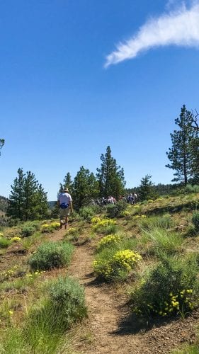
Fall River Trail
West of Sunriver

West of Sunriver along South Century Drive, the spring-fed Fall River arises and meanders twelve miles to its confluence with the Deschutes River. From the headwaters near the Fall River Guard Station, the river courses through mature pine forests and wet meadows where wildflowers such as triangular-leaf senecio, yellow monkey-flower, white bog orchid, scarlet gilia and blue-eyed grass hug the banks. In the drier uplands, a mix of wildflowers and shrubs such as western wallflower, Brown’s peony, Columbia puccoon, mountain trumpet, antelope bitterbrush, wax currant and green manzanita, named after its “little apples,” bloom along the trail. Visit fs.usda.gov for more information.
Trail length: 5 miles out-and-back from the Fall River Guard Station, relatively level.

Gray Butte
Northeast of Smith Rock State Park

Gray Butte is part of the Crooked River National Grasslands and offers trails for hikers, horse riders and mountain bikers to explore this high desert environment. The Cole Loop trailhead departs off Forest Road 57 across the road from the McCoin Orchard, a homesteader’s orchard planted in 1886, and contours around the west and south sides of Gray Butte before descending to the Skull Hollow Campground. Spring wildflowers abound along the trail and include Cusick’s elkweed with its light-blue four-petaled flowers, rough eyelashweed, yellow desert daisy, parsnip-flowered buckwheat, Douglas’ brodiaea and daggerpod—a member of the mustard family that bears slender daggerlike seed pods. Exceptional views of the Cascades compliment this hike. A vehicle shuttle from Skull Hollow Campground back to the trailhead is recommended. Visit fs.usda.gov for more information.
Trail length: roughly 6.2 miles, one-way, with 1,550 feet of elevation change.
Editor’s Note: This story was originally published in May, 2020.


