
In Central Oregon, hiking season is year-round. When there’s snow in the mountains, head to these lower elevation trails throughout the region. Closer to town or in canyon country, these trails usually stay clear of snow throughout the winter months.

Deschutes River Trail, Awbrey Reach
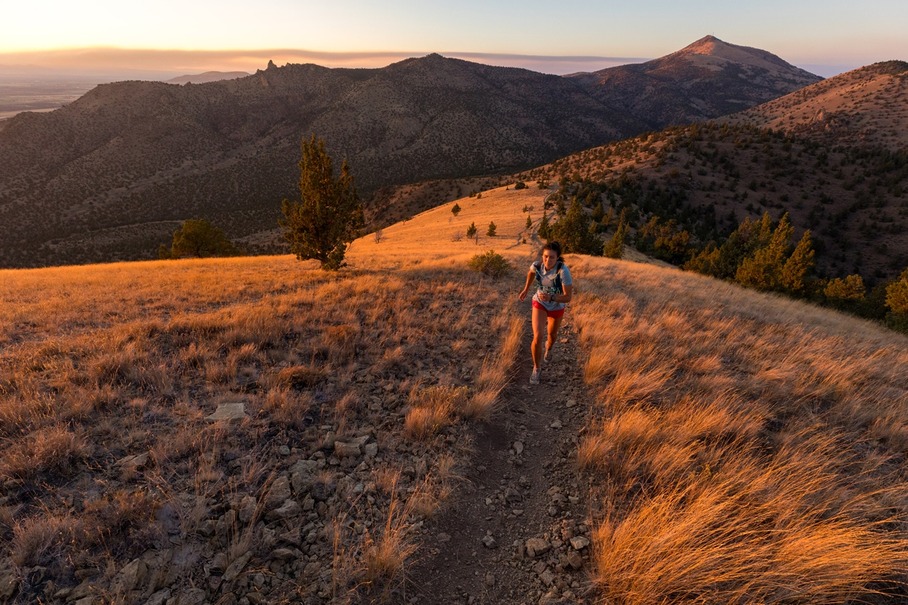
When it comes to urban trails around Central Oregon, few are as visible or iconic as the Deschutes River Trail. Really a patchwork of multiple trail segments and, in some cases, streets or sidewalks, the river trail more or less connects Sunriver to Awbrey Butte on the north side of Bend. Within the city, a good portion of the trail is located in, or above, the scenic Deschutes River Canyon. The riverside segments offer views of tumbling whitewater, old growth ponderosa pines and a bevy of wildlife.
The most heavily traveled section upstream of the Old Mill District can see as many 12,000 visitors in peak months, according to the Bend Park and Recreation District, which manages most of the trail systems around Bend. Come late fall, however, the number of visitors drops off sharply. This is a great time to get out and explore in the crisp autumn air, and maybe work off an extra serving of holiday dessert.
If you really want to ditch the crowds, head to Sawyer Park where you can pick up the most northern segment of the river trail, known as the Awbrey or Archie Briggs stretch. Begin the hike by crossing the footbridge in Sawyer Park where you’re likely to spot woodpeckers, quail, ducks and more. From there, head northwest on the gravel and sand trail as it climbs gently around the base of Awbrey Butte. The trail crosses Archie Briggs Road and continues to climb, offering views of the middle Deschutes River below. The trail continues north, opening to a panoramic vista of the Three Sisters and Black Butte. Once inside Archie Briggs Canyon, the trail edges close to the canyon rim, offering dramatic views of the Deschutes River hundreds of feet below. The trail continues along the canyon rim for almost another mile before it terminates at Kirkaldy Ct. near Awbrey Glen Golf Club.
The park district already has plans to connect the trail to its Riley Ranch property to the north via a bridge over the Deschutes River, but trail construction is several years off. “Long term the plan is for [Bend Parks] to make a connection from Sunriver clear down to Riley Ranch and on to Tumalo State Park,” said Brian Hudspeth, development director for Bend Park and Recreation District.
For now, the Awbrey Reach of the river trail is mostly used by nearby residents for a morning or afternoon stroll or run. And while there is no loop option, the spectacular scenery and urban solitude make the out-and-back hike well worth a short trip to experience this lesser known gem.
Background: The Awbrey Reach is the most northern section of trail, connecting Sawyer Park to the trail’s terminus near Awbrey Glen Golf Club. The section was developed more than a decade and a half ago when Tumalo Irrigation District (TID), working with the Deschutes River Conservancy, piped more than two miles of TID’s main feed canal. Beginning at First Street Rapids, the route created the perfect alignment for a river trail along the old canal route.
What to Know: The out-and-back trail measures a little less than two miles from Sawyer Park to Kirkaldy Ct. on Awbrey Butte with impressive river canyon and mountain views. The trail is a soft surface for the entire stretch, making it ideal for trail runners and walkers and features only moderate climbing.
Flatiron Rock Trail, Badlands Wilderness

There are dozens if not hundreds of miles of hiking trails in the Badlands Wilderness area east of Bend. The most popular destination is within the southeastern section of the 19,000-acre high desert wilderness where abundant rock formations and ancient juniper trees speak to the area’s volcanic history. While lacking some of the dramatic alpine vistas associated with other Central Oregon hikes, the Badlands offers a relatively close escape that’s accessible to hikers and trail runners when most of the high country is not, making it a perfect late fall hike.
The Oregon Natural Desert Association’s (ONDA) Gena Goodman-Campbell recommends that new visitors begin their desert explorations by parking at the Flatiron Trailhead and following the eponymous trail that forms a roughly six-mile loop. The trail winds through the native juniper forest providing visitors a chance to glimpse the old growth juniper trees, some of which are more than one thousand years old. (Old growth juniper are distinguished by their expansive and non-symmetrical tops, whereas younger trees tend to have a conical shape). Hikers will also see the signature Badlands Rock, one of the more visually dramatic features of this understated landscape.
The culmination of a years-long wilderness campaign led by ONDA, the Badlands was formally designated by President Barack Obama in 2008. Today, the Badlands is a place of quiet contemplation where the vastness of the Eastern Oregon desert and the forces of geology meet just minutes from Bend. Other notable features around the area include the large dry riverbed canyon, which can be glimpsed from Highway 20 just east of Horse Ridge. Explore the Badlands Trails and numerous lava tubes that some 20,000 years ago transported lava from the nearby Newberry Crater, creating the unique volcanic features seen today.
Background: The Badlands was once a BLM grazing area and ad hoc dumping ground, but restoration and education efforts along with a federal wilderness designation have restored the area to a pristine state. Today, the area is maintained by staff from the Prineville BLM office and a cadre of volunteers known as the Friends of the Badlands, or, as they are affectionately known, Fobbits.
What to Know: With roughly 19,000 acres available for exploration, there are multiple trailheads and parking areas that offer access to different areas within the wilderness boundary. BLM trail maps are available and can be downloaded. Note that it’s easy to make a wrong turn in the crisscrossing network of trails. If you plan an extended excursion, a map and GPS will serve you well.
Scout Camp Loop, Crooked River Ranch

It’s been more than a decade since the Bureau of Land Management formally developed the Scout Camp Trail in Crooked River Ranch, but the spectacular hike into the heart of the Steelhead Falls Wilderness Study Area has been eons in the making. Today’s hikers and anglers are just the latest in a long line of visitors to this dramatic canyon that shows signs of inhabitants reaching back several thousand years. Cliff paintings, primitive cave shelters and shell middens all speak to the role that this rugged and beautiful area has played as a source of food and shelter throughout the ages. Today, the area is accessible via several primitive trails located on the far edge of Crooked River Ranch, a sprawling residential community that straddles a peninsula hemmed in by the middle Deschutes River to the west and Crooked River to the east.
The Scout Camp Trail is the northernmost of the developed trails in the Steelhead Falls Wilderness. Depart from a small parking area at the end of a short dead-end street on the far northeast side of the ranch, about half an hour’s drive from downtown Redmond. Hikers proceed through a rather unspectacular juniper forest for about a quarter mile before reaching the edge of the canyon where the landscape parts dramatically. The Deschutes River courses below, framed by Cascade mountain peaks above the opposite side of the canyon.
“It’s pretty obvious how special this place is. You see millions of years of geologic history, and it’s just breathtaking,” said Gena Goodman-Campbell, who has spent as much time in the canyon as about anyone else around as the wilderness coordinator for Oregon Natural Desert Association (ONDA). The Bend-based organization has been seeking permanent protection of the area by formally designating roughly 18,000 acres within the canyon as federal wilderness. Despite local support, that work remains stalled in Congress, which has been reticent to expand the inventory of designated wilderness. Congressman Greg Walden, who represents Central Oregon, has proposed a bill that removes some of the existing protections to loosen regulations around fire suppression in the area. Goodman-Campbell said the proposal, which has been developed with little input from stakeholders like ONDA, is an example of why additional protections are warranted.
Politics aside, it’s obvious to anyone who visits that Scout Camp and the Deschutes Canyon are gems of Central Oregon—the kind that take a little extra work and perseverance to discover, but reward the effort with a tantalizing glimpse into the region’s rich geologic history.
Background: The Scout Camp trail was developed by the BLM and is one of several trails that provides access to the rugged canyon where the Deschutes River cuts through the desert landscape. The thousand-foot-deep canyon is part of the Steelhead Falls Wilderness Study Area. ONDA proposes permanent preservation of the area as the Whychus-Deschutes Wilderness.
What to Know: The Scout Camp Trail is a three-mile loop that descends steeply into the heart of the Steelhead Falls Wilderness Study Area. The trail requires that hikers scramble over a rock pile at the edge of the river. The move is semi-technical and not marked. If you find yourself near a small antennae and solar panel, you’ve reached the obstacle.
Chimney Rock

Between Memorial Day and Labor Day, you’d be hard pressed to find an open campsite on the Crooked River near Prineville, especially on a weekend. Come late fall, things begin to slow as cool weather moves in and crowds thin. There is still plenty to enjoy, however. Anglers, hikers and just about anyone with an affinity for the outdoors are drawn to this picturesque river canyon for its great fishing and Instagram-worthy backdrops. Towering basalt walls soar up to 600 feet, framing a blue-ribbon trout fishery that tumbles through the canyon. Bald eagles, osprey and dozens of species of waterfowl are common sights.
While there are limited hiking options within the twelve-mile federally designated wild and scenic portion of the river canyon, the relatively short, if steep, hike to Chimney Rock is a great out-and-back trek. While there is some sustained climbing involved, the level of difficulty is relatively low, making this a hike that can be enjoyed by multiple generations, including young children who can usually be cajoled or bribed if necessary into completing the two-and-half-mile roundtrip.
There is ample parking at the trailhead on the east side of the river. Pack some water and a light snack that doubles as collateral when negotiating with reluctant children. The trail follows a narrow draw in the canyon wall, switchbacking up the side of the canyon for about a mile. Eventually, the trail grabs the west-facing canyon wall, affording hikers views of the river and terrain below. Follow the trail as it climbs to the top of the canyon, skirting the rimrock along the way to your final destination, Chimney Rock. At this large basalt outcropping, hikers can scramble out to a narrow perch that offers views of distant Cascade peaks and the twisting river canyon below.
Background: Hudson Bay trapper Peter Skene Ogden was the first European to leave written accounts of his travels and explorations along the Crooked River in the 1820s. White settlers arrived decades later after the land was ceded under the treaty of 1885 by the Confederated Tribes of Warm Springs to the federal government. The tribe retains hunting and fishing rights in the area.
What to Know: The Chimney Rock day use area is roughly seventeen miles from Prineville, but can also be reached directly from Bend via Alfalfa Market Road. There are nine developed campsites in the Lower Crooked River Wild and Scenic section, including the Chimney Rock campground adjacent to the day use area.


Pingback:6 Day Trips for Spring Break in Central Oregon — Bend Magazine