As you descend from the main trailhead at Smith Rock State Park outside of Terrebonne, it’s hard not to be impressed by the majesty and beauty of the iconic Central Oregon landmark— the orange-red hues of the vertical rock faces, the tranquil, meandering Crooked River in the foreground and the impressive antics of climbers dangling from sheer rock hundreds of feet above the ground. In fall 2023, a new, wider footbridge was christened and now visitors have a safer and sturdier gateway to the park’s multitude of outdoor activities. Though the park may be best known for its climbing, spring is the perfect time to hike as well, both to beat the throngs of summer visitors and the soaring temperatures. Here are the three trails we recommend for some of the best early-season hiking in the park.
Misery Ridge
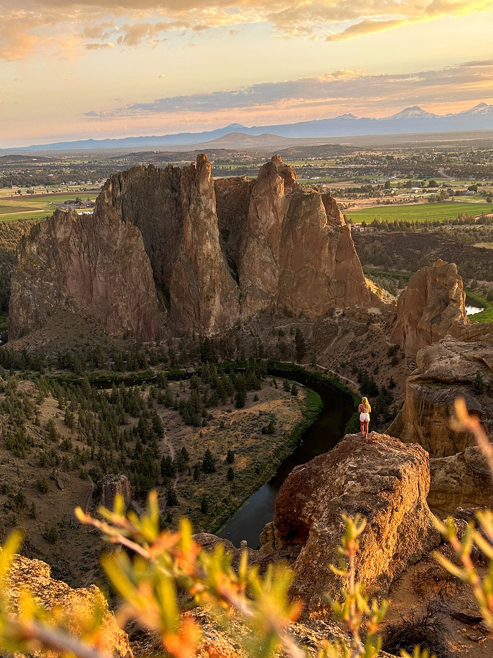
Misery may love company, as the adage goes, but for many outdoor enthusiasts in Central Oregon, Type II fun is often the most rewarding, leading to jaw-dropping vistas—as well as an excuse for a post-hike pint. The Misery Ridge Trail is one of the park’s most iconic, and for good reason. The views from the top make the uphill burn worth it, with a panoramic vista of the Cascade Range, including the Three Sisters, Mount Bachelor, Broken Top, Mount Washington, Mount Jefferson, Three Finger Jack and Black Butte, among other Central Oregon geological landmarks. If you have a compact pair of binoculars, bring them along for spotting both wildlife and the high life of sport climbers.
To begin the hike, park at the main trailhead and day-use area near the Welcome Center. Follow pathways north past a picnic shelter to begin the short descent to the river. Before you do, be sure to take in the spectacular view of the south-facing rock formations and the Crooked River at its base. Keen eyes may be able to spot climbers high up along the walls–and if you brought binoculars, this is a fun spot for a quick scan. After the descent, pop out at the newly reconstructed footbridge. Stay straight at the junction after crossing to continue onto the Misery Ridge Trail, which very quickly provides first-hand experience to how it got its name by gaining more than 600 feet of elevation in approximately a half mile. Though punishing, the quick ascent also provides a wonderful excuse to stop and take in the expansive scenery as you catch your breath.
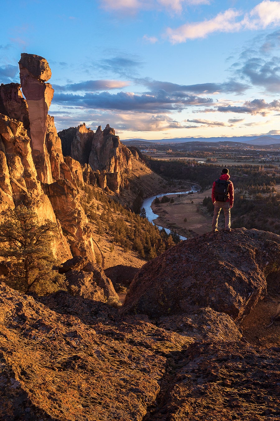
Once on top, the views really begin to open up. On clear days, the volcanic peaks of the Cascades, as far south as Mount Thielsen and Mount McLouglin, are visible all the way north up to Washington’s Mount Rainier. As you skirt along the ridgeline, you soon come head-to-head with one of the park’s more notable climbing routes, Monkey Face. Fortunate timing may offer you a glimpse of climbers as they summit to the top of the 350-foot spire which, indeed, has a striking resemblance to a monkey face. Begin the descent through a series of steep switchbacks down to the Mesa Verde Trail and soon after, the River Trail. From here, it’s an easy and flat 2-mile return along the Crooked River back to the bridge to complete the loop.
Trail length: 3.6 miles round trip
Elevation gain: 908 feet
Difficulty: Moderate after the initial ascent
Homestead Trail to Canyon Trail
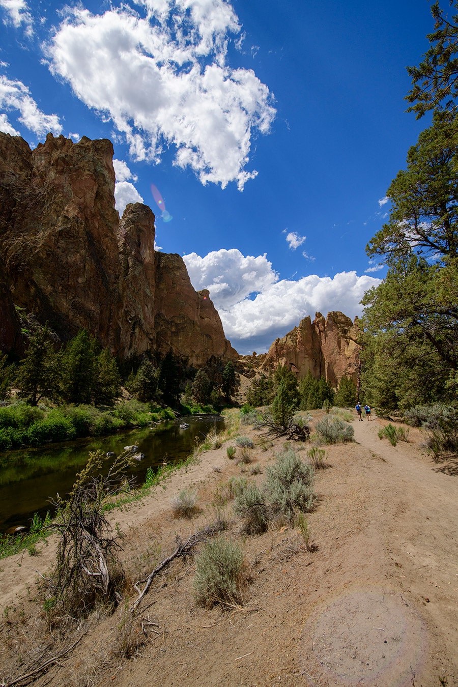
For those wanting a milder hike, the Homestead Trail stays low along the Crooked River. Park at the far northern end and locate the trail at the apex of the turn-around. Descend a short section of switchbacks to the river and turn left to go toward the center of the park. Within a half mile, you’ll pass by the footbridge. Instead of crossing, keep straight along the southern side of the river onto the Canyon Trail.
This is a wonderful route for both hiking and photography as it offers so many angles of the impressive southern side of the rock formations. Additionally, if you time the hike just right during the morning or evening hours, you’ll be rewarded with a kaleidoscope of changing colors. If you choose to hike the out-and-back Canyon Trail in its entirety, it will take you 1.6 miles to the southern boundary of the park. Turn around here, or to make the hike shorter, simply turn around at any point prior. On the return, you can shorten your hike even more by veering up the Chute to the main parking area and walking along the paved path back to the turn-around.
Trail length: Up to 4.8 miles round trip with multiple options to shorten
Elevation gain: 250 feet
Difficulty: Easy
River Trail – Summit Trail Loop
The dramatic and varied options of Smith Rock State Park, make it hard to narrow down a visit to just one hike. So why not choose one that takes it all in? Circumnavigate the entire park by connecting the River Trail, Summit Trail, Burma Road and the Wolf Tree Trail for a 7-mile hike of ups, downs and all-arounds. With more than 1,200 feet of elevation, it’s not a loop for the faint of heart. But, for those up for the challenge, the rewards are incredible vistas that the bulk of visitors to the park rarely ever see.
Trail length: 7 miles
Elevation gain: 1,253 feet
Difficulty: Difficult due to elevation and distance.
Know Before You Go
Day-use parking permits are required at Smith Rock State Park and can be paid via self-service kiosks along the main parking areas (credit and debit cards accepted). Limited camping is available on a first-come, first-served basis beginning March 15. Click to read more OUTDOOR ADVENTURE ARTICLES with us.

