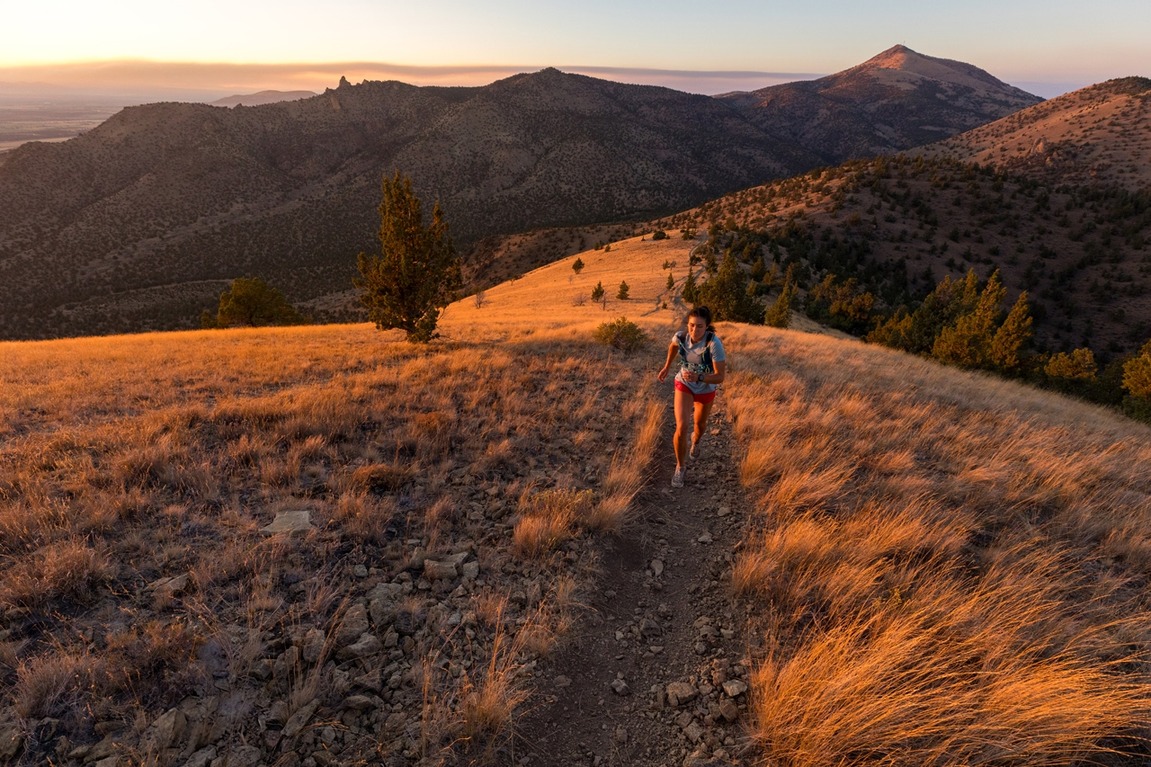
Immerse yourself in the beauty of the best fall hikes in Central Oregon as leaves tumble in shades of orange and yellow through the crisp autumn air. Prepare your hiking shoes, pack a delightful lunch, and fill your water bottle, for now, is the opportune time to explore these trails before the arrival of snow and the seasonal closures that follow.
Metolius River
This is a great hike for families. There’s a fish hatchery at the start of the hike that is fun for kids and parents to explore. The trail stays relatively flat as it follows the Metolius River, but there’s a lot to see, including many different springs that appear from the banks of the river. Hiking among the trees, you can easily forget that you’re actually in the high desert of Central Oregon—it feels more like you’re on the wetter side of the Cascades. The Metolius River area is a small, green oasis that pops with color in the fall.
Driving Directions: Take the Camp Sherman turnoff from Highway 20. Follow road 14, and take the right at the fork. Continue for about 7.5 miles, then turn left at the Wizard Falls Fish Hatchery. Follow the signs across the bridge to the parking area.
Difficulty: Easy
Distance: 4.6 miles out and back.
Dogs: Must remain on a leash.
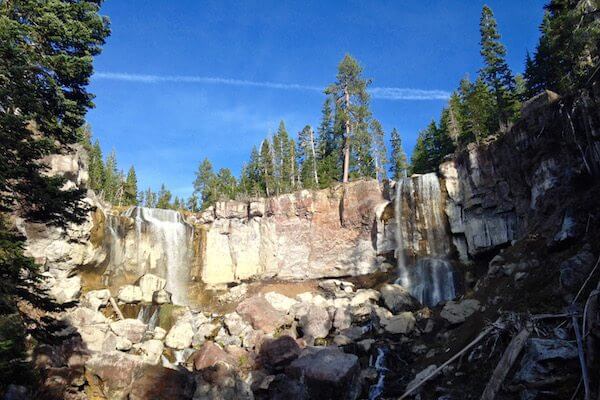
Other: There are two routes you can take, starting from the hatchery. The upper part of the hike is the easiest and will take you to a small waterfall at the end.
Scout Camp
The hike is part of a new network of trails along the Deschutes and Crooked Rivers. While the hike is relatively short, there’s a lot of adventure in store. This narrow trail descends 700 feet into the canyon.
Driving Directions: Take Lower Bridge Road west on Highway 97, drive about 2 miles, turn right on 43rd Street. Follow for two miles, then turn left on Chinook Drive. Follow about 2.5 miles, then turn left onto Mustang Road. After about a mile, turn right on Shad Road. Then drive another 1.5 miles and turn right on Peninsula Drive. Follow for 3 miles, then turn left onto Meadow Drive. In about .5 miles, turn right onto Scout Camp Trail. Parking and trailhead is at the end of the gravel road.
Difficulty: Moderate
Distance: 3-mile loop
Dogs: Allowed.
Other: No bathrooms or water at the trailhead. A little over a mile in, there’s a 10-foot-tall rock that you’ll have to scramble over.
Shevlin Park
There are 652 acres available to explore in this forest on the outskirts of the city. Because the park is mostly flat, the trails can easily be used for running or for hiking with kids and family. October is the best time to visit when the leaves are at their peak fall colors.
Driving Directions: Follow Newport Avenue west until it turns into Shevlin Park Road. Follow for about 1.5 miles. Parking is free and on the left side of the road.
Distance: Almost 10 miles of trails, but there are plenty of options to shorten your route.
Dogs: Allowed.
Other: This is a popular spot because of its location in Bend, and parking can be limited. You’ll want to share the trail with mountain bikers, too.
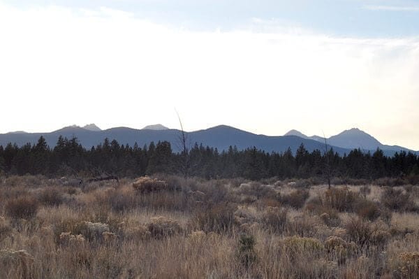
Paulina Creek Trail and Falls
About a 30-minute drive south of Bend in the Newberry National Volcanic Monument, the trail along Paulina Creek offers varying terrains. With steep elevation changes and several rocky areas, this is a hike for families with older children. If you do hike the almost 17 miles in one day, you’ll want to start early, pack a lunch and bring plenty of water.
Driving Directions: Take Service Road 21 off Highway 97, then follow signs to Paulina Lake. Continue on the road until you reach the Peter Ogden trailhead.
Difficulty: Difficult if you hike the whole trail, but there is also a good turnaround point less than halfway at McKay Crossing.
Distance: 16.6 miles out and back
Dogs: Allowed.
Other: Open through November. Horses and bikes may be on the trail. Parking and hiking is free.
McKenzie River and Tamolitch Pool
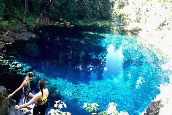
At the crossroads between the Willamette Valley and the high desert of Central Oregon, the McKenzie River hike takes you through many different terrains. While you’ll start the hike among the green Douglas firs, as you gain elevation, you’ll find that the landscape transitions into the dry and rocky ground that dominates in Central Oregon. It’s four miles to Tamolitch Pool. From the top, the view over the pool is stunning. There is a steep descent if you want to get close to the water. The water is unbelievably clear and blue. The best time for swimming is summer. The water is icily cold, and the bottom of the shallow pool is visibly chunked with boulders.
Driving Directions: Take the Koosah Falls/Ice Cap Campground exit on Highway 126. Follow the signs to the parking area and trailhead.
Difficulty: Moderate.
Distance: 4 miles out and back
Dogs: Allowed.
Other: This is a favorite trail among mountain bikers, so you’ll want to be aware of them.